diumenge, 14 de juny del 2015

Road s'Ermita

S'Ermita is a small chapel dedicated to the Virgin was built in 1954 on top of Sa Rovellada, and which can be reached in half an hour walk from the village of Ferreries.
See the video below:


length of the route
difficulty
shade?
water sources?

clock-512_.png


20 minutes
from Ferreries
articulos_469_B.jpg


medium difficulty

path

I unpaved

way to climb
sun.png


During the climb there are few areas of shades.

At the top

There is an oak.

water-glass-512.png

There is a well.

Natural water.

Another access point s'Ermita:

From the Place Francesc d'Albranca, Avenue Son Morera, near the sports area. Next to the school Castle of Santa Agueda is a signpost pointing to an oak and visible way is flat first and then suddenly up to the summit of the mountain.

 Second access point from the Place Francesc d'Albranca.


 Conditions and benefits

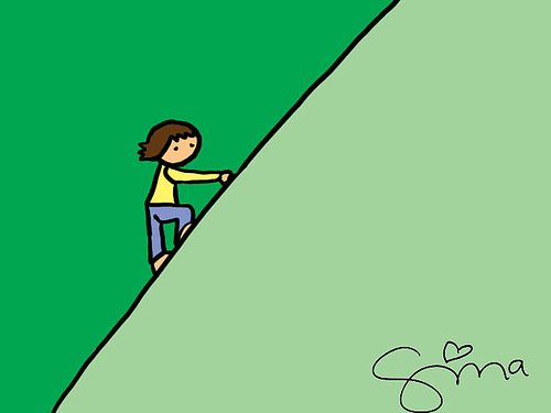
The ascent to the top is smooth and the end is more pronounced.

Climb 180 meters


 Source image: Menorca.es


 Area with a table and stone benches under oak. Photograph: Gonzalo Buenaventura

TOUR


 The views. S'Ermita viewpoint.

 East View


(1) Elevation Son Arro

(2) above Granada Area

(3) Mountain Ses Fonts Rodones. Massif that forms a plateau interior.

(4) Marine Santa Rita

 View North


 (1) Coastal and elevations Sa Terra Rotja and Ruma. Lands covered by a low vegetation of reeds and wild olive Redolar mixed with farmland and pasture. They are relatively fertile and productive land.

(2) Small valley where one part of the old Camí of Kane

(3) Mountain of S'Enclusa

 Source
 Fraga Arguimbau, Pere (text) Alberdi, Carles (illustrations)
 Rutes Naturals de Ferreries. Itineraris i miradors.
[Natural Ferreries routes. Itineraries and viewpoints]
Posted by ajuntament Ferreries

 Who built it?

Chapel was built by volunteers and paid for with the money of the people of iron. The promoters of the construction of action were young Catholic who was 50 years a powerful association people. Young people each evening, at the end of work amounted to load and build.

 Who cares?

Chapels Menorca
]+++
During the first half of the twentieth century (1900-1960) were built shrines practically all the peoples of the island.

If clic here you can see photos of other churches.

Who built s'Ermita?

The promoters of the idea of building s'Ermità was young Catholic Action, which were animated and directed by the Vicar of Ferreries conciliate and Mr. Llorenç Olives. S'Ermita Mariano was built in 1954 in order to record the great devotion that the people of Ferreries felt and professed by the Mother of God.


Catholic Action Association was in the 50s had a lot of vitality in our village.


In the center Jose Maria Asensio. Right, Jose Maria Allés (Furniture Allés) who was in charge of reading a poem.

published by Agustin Pons Marin to old photos of Menorca

How they built the Hermitage?

It was not easy. There were many young people at the end of your workday spent algunes few hours which helped in the construction of the small chapel. All material was uploaded to the spine d'few donkeys, with bast i escorballa was a very expensive work, hard work and sacrifice; but thanks to the enthusiasm of the people, and before long, the chapel was finished brilliantly.


On top of s'Ermità. 1954. Ferreries.

Biel Canaleta in Xec "Curia Blanca" in Damià Canaleta in Bartomeu Florit Huguet, n'Huguet i Juanito Retxilleres.

old photos published in MENORCA

That day was blessed and soon became a popular and religious festival. Virtually all the people went up into the mountain, praying the rosary and singing religious songs and populare. It was a great celebration of pilgrimage as

He never before has been seen in our village.


 1954. Visit S'Ermita. Layeta album. File Parish Ferreries.

Photo shared by Maria Florit Barber in Fets i gent Ferreries


 Source used:

Pons Barber, Juanita and Martí Pons, Victor.


Popular-religioses Tradicions temps d'es Passat.

Impremta Rotger, Ferreries.

The quotations are in blue


Who cares s'Ermita?

Volunteers are responsible for seeing s'Ermita. Since it was created (1954) until now.

Currently, a person up there every week to water the flowers.

And once a year a small group liming and make general filed.


Thanks to them, when you climb,
We all found it beautiful.
Team of volunteers who every year climb to whitewash and to make clean. June 2015.

The walls are not painted alone.
Behold, you have been clean !!!

Path to Lourdes (Ferreries)


length of the route
difficulty
shade?
water sources?

clock-512_.png


15 minutes
from Ferreries
way-512.png


easy

path
attention to the road
Ferreries-Migjorn
Forest-512.png

Site with oaks.

_318-60936.jpg

No well or source
Video


Album  Layeta. File Parish Ferreries.1958. Carrying the Virgin in Lourdes. Ferreries. - Laieta with Margaret and Mrs. Angeles Tirasec of Alles Camps.

Road Camí Reial of Ferreries

The road Camí Reial was also known as Old Way and was one of the oldest roads between Maó and Ciutadella. Its original route passed through the center of the island of Menorca and crossed populations such as Ferreries, Migjorn Gran, Es Mercadal and Alaior. Its origin is medieval, although it is possible that this will be created on an old Roman road.
The section of Ferreries was happily recovered in the 90s thanks to the enthusiasm of a group of young Red Cross Ferreries, who dedicated much effort to leave it clean and cleared, signaling to him and to know and publicize its historical aspect.
Currently preserved and kept clean thanks to the collaboration and participation of some organizations of people who have "adopted" some small sections that dedicate their conservation work Camí Reial throughout the year. A great example of love and commitment by Ferreries.
A stretch of 3.5 km from Camí Reial to enjoy all the charm of nature, the diversity of plants, trees and animals to enjoy their sounds, their colors, their historical points. Enjoy much!

Video Road Camí Reial of Ferreries


Lenght of the route
Difficulty
Shade?
water sources?

clock-512_.png


Distance: 3,5 km,  
Lenght of the route:between 45 minutes to 1 hour from Ferreries
 The route can begin from town hall or Cemetery Ferreries
way-512.png


easy
rural road
Forest-512.png

Site that combines oak with other tree species.

_318-60936.jpg

No wells or sources

Points of interest in the Camí Reial:

1-Es Pouets. Old building dedicated to supplying the inhabitants of potable water Ferreries. They were originally four wells that allowed effectively get some water for most people. It seems that the origin of these wells dating back to 1642 and were known as "sa fontassa". It is likely to do a hundred years that two of the wells were plugged, as still can be seen; so, we can see the balance and functional simplicity of its forms. On the left side there is staircase leading up to a roof that was planted long ago like a small orchard.

The wells are deep enough and it appears that collect water by seepage of rainwater collected from behind. There is sure to have "vein" but Es Pouets have deserved reputation of giving a very good water.


2-Sa Creu de Son Gornés. Tribute to the family of a young man who died near the spot because of lightning fell on him while he took refuge from a storm. It occurred on September 21, 1865.


Resultat d'imatges de Pou de Sa Perdiu Blanca

3-Es Pou de sa Perdiu Blanca. Well and construction made of stone and consists of 3 small arches that had the function of channeling and bring water. There is also a story of a legend with the same name of this place: 
The mysterious story lies precisely in the well with the same name found in one of the most beautiful stretches of the old Cami Reial part that still remains between Ferreries and ravine d'Algendar. In the well, in which many people in the legend took the opportunity to stand on the road and quench their thirst, is where a partridge white the protagonist, a young Ferreries appears to him as he headed Algendar, place young resident who starts a romance.
 Resultat d'imatges de Pou de Sa Perdiu Blanca

4-Sa Cova Real. When the road crosses over land Algendar a piece later Es Pou de sa Perdiu Blanca, find Sa Cova Real (Cave Real). Besides probable prehistoric use as housing, its role in our route is to be an important point of reference among those who made way. A goatherd, a farmer or a hunter could make it serve as a shelter in case of bad weather, or just be there to stay in the cool shade of the cave during the summer.

Situated on a small tarball widening the right of the road is not too big cave, but inside it should be a good group of people. It is open on a rocky wall delimiting the same way that oddly named


Resultat d'imatges de Pou de Sa Perdiu Blanca
 5-Sa Costa de na Salema. Not far from Sa Cova Real you can see a long climb known as Na Sa Costa Salema. This name reminds us of a clear origins of "Moorish times". In this regard we know that the word "Salema" comes from Arabic and means "peace", "serenity", "happiness". Therefore Coast Na Paz, Na Serena, Na Feliz, but as an expert farmer the Menorcan countryside, Joan of Saranjassa said it could also refer to a parcel of property Algendar, adjacent to the Cami Reial, which has this name and is located on the left side. At the top of the hill very soon we find the current access road leading to the Barranc de Algendar, is the point where the asphalt ends just in front of the barrier properties and Algendar Algendar Vell Nou. 
 Resultat d'imatges de Sa Costa de na Salema

If you want to extend the tour you can go straight down to the Barranc de Algendar, considering however that the true journey would not it Canalo but through Es Pas de In Revull another step happily recovered lately and that You can enjoy a lot. After Es Pas d'En Revull the road enters the beautiful deep ravine Algendar links with the Old Road that leads to Ciutadella.